

The Meteorological and Geophysical Bureau (SMG) issued typhoon signal no. 3 at 7 am today as Tropical Storm Mitag gets nearer to Macau and the surrounding areas, with the SAR already getting prepared for Super Typhoon Ragasa that is expected to affect Macau in the coming week.
According to SMG, the current typhoon signal no. 3 will remain in force during daytime today, with a relatively low possibility of issuing signal no. 8 between tonight and early morning tomorrow.
The weather bureau has pointed out, however, that due to its relatively small circulation and ongoing uncertainties regarding the typhoon’s intensity and track, it is possible that Mitag will take a path closer to Macau than expected. Therefore, the possibility of issuing a higher typhoon signal cannot be ruled out.
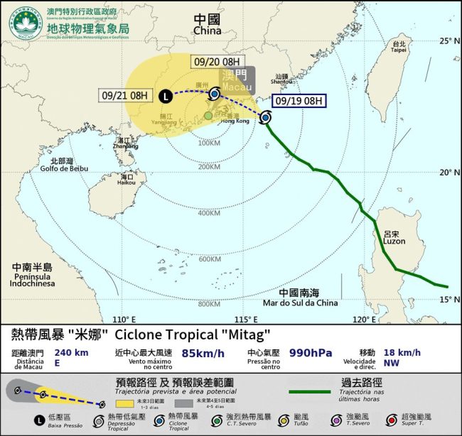
As of 8 am, Mitag was estimated to be about 240 kilometres east of Macau, located at the northeast of South China Sea and moving northwestward towards the coastal area of eastern Guangdong and gradually strengthening. Based on the current forecasts, Mitag is expected to enter within 200 kilometres of Macau later today, with the local winds expected to strengthen.
Affected by Mitag’s outer circulation, Macau is expected to experience more thundery showers with winds strengthening today, with frequent heavy showers and thunderstorms, accompanied with gusts, expected tomorrow and on Sunday. In addition, flooding may occur due to short term heavy rainfall.
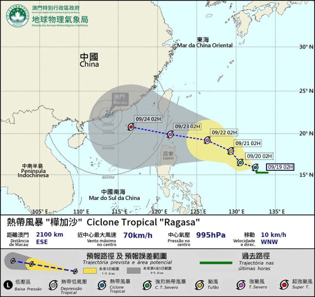
Meanwhile, at 2 am early today Ragasa was estimated to be about 2,100 kilometres east-southeast of Macau over the northwest Pacific Ocean and is forecast to be moving west-northwest at a speed of around 10km/h.
According to the current forecasts, Ragasa will start approaching Macau and the surrounding areas early on 23 September, with the super typhoon predicted to enter within 400 kilometres of Macau early on 24 September.
The public is advised to pay attention to the latest weather updates in Macau and take appropriate precautions as necessary. For more information about the local weather visit SMG’s website. (Gilbert Humphrey)
Images: Neenu Vimalkumar, SMG

COMMENTS