
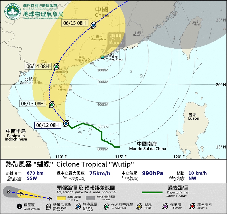
Meteorological and Geophysical Bureau (SMG) hoisted Typhoon Signal No. 3 at 6 o’clock this morning as Tropical Storm Wutip, this year’s first typhoon, gets closer but the possibility of the bureau issuing Typhoon Signal No. 8 is relatively low, according to the city’s weather forecast, updated at 8 am today.
At around 8 am, Wutip was in the central part of the South China Sea, moving northwest towards Hainan Island as it continued to intensify.
Under the combined influence of high-pressure ridge, the wind on the bridges is strong and – due to the influence of Wutip’s outer rainband – it will remain so for a period of time.
Based on the current forecast, Wutip will turn north to northeast and move closer to the western coast of Guangdong tomorrow (13 June), and the wind in Macau will strengthen, while the impact on the SAR will be “significant” from late Friday to early Sunday, particularly with heavy showers and thunderstorms, according to SMG.
SMG has advised the public to pay close attention to the latest weather updates and take precautions against strong winds and, in low-lying areas, flooding. (Gilbert Humphrey)
Image: SMG

COMMENTS