
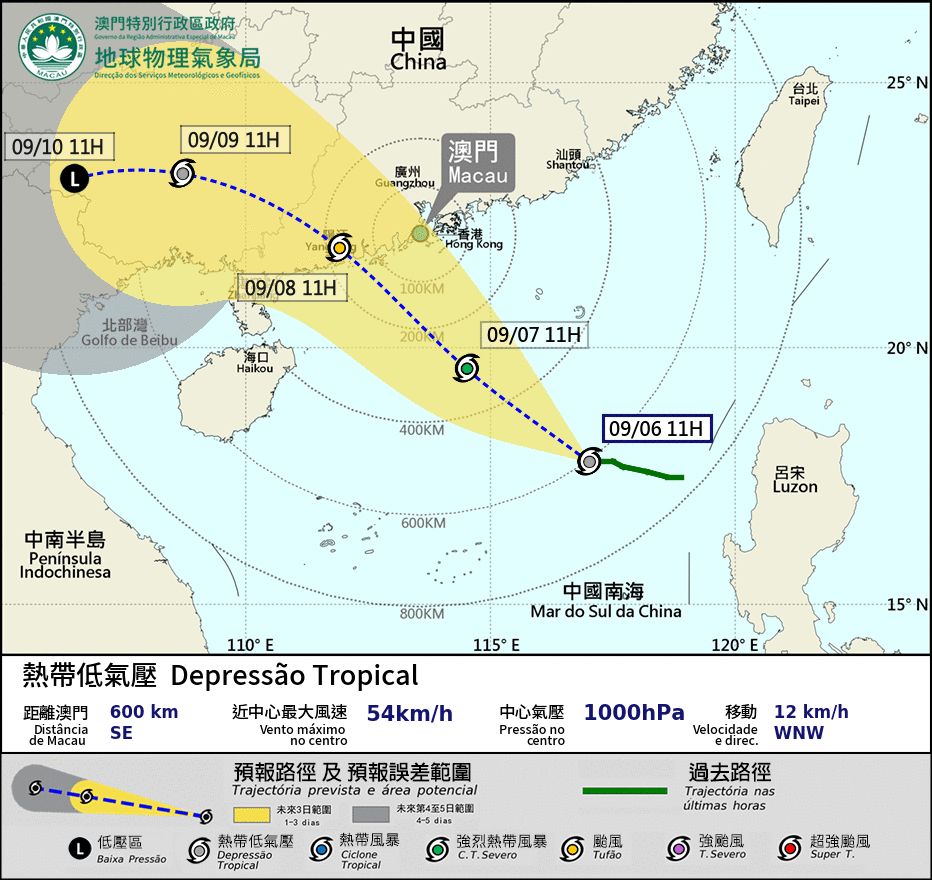
The Meteorological and Geophysical Bureau (SMG) issued typhoon signal no. 1 last night as Typhoon Tapah moves towards Macau and the surrounding areas, with a high possibility of raising it to signal no. 3 tomorrow afternoon (7 September).
Tapah is currently located in the central part of the South China Sea and is expected to move northwest over the next two days, generally heading toward the western coast of Guangdong, and will gradually intensify, according to SMG.
Based on the current actual tropical cyclone track, Macau may raise the signal higher than no. 3 early on Monday (8 September), unless the actual tropical cyclone track changes.
The local weather bureau has pointed out that there will be increasing showers and thunderstorms tomorrow, with winds intensifying.
Meanwhile, coinciding with the astronomical spring tide over the coming days, low-lying areas may experience flooding caused by storm surge during daytime on Monday, with an expected flooding level of around 0.5 meters. Therefore, the chance of issuing a blue storm surge warning is high on Sunday morning, according to SMG.
Local authorities have warned the public to pay attention to the latest weather information and to take precautionary measures promptly. For more information about the local weather visit SMG’s website. (Gilbert Humphrey)
Image: SMG

COMMENTS